History
THE HISTORICAL BACKGROUND OF DELRAN TOWNSHIP
By: Lloyd S. Griscom
The history of the territory now known as Delran Township began long before the present name was given to the area in 1880. Under two earlier township names, the history goes back to 1692, and under a still earlier designation, it extends back to 1682. Prior to that year, the area was known under Native American titles.
In reviewing the history of Delran, the five periods will be considered in this sequence:
- The Native American Period ( -1682)
- The “London Tenth” period (1682-1692
- The Chester Township period (1692-1860)
- The Cinnaminson township period (1860-1880)
- The Delran Township period (1880- )
THE NATIVE AMERICAN PERIOD
The ages of Native American occupancy of this region extended to a time long before written accounts. The natives of the Lenni-Lenape race, giving their name to the river by calling it Lenape-Wihittuck – the “rapid stream of the Lenape” – were of the parent Algonquin race. In the early 1600’s, after the naming of the river for its European discoverer, the Lenni-Lenape were commonly called the Delaware Indians.
These natives, dwelling on either side of their “rapid stream” were divided into three basic tribes. Those adjacent to the northern Delaware constituted the Minsi tribe; the ones along the middle portion of the river were the Unami Indians; and the tribe on the lower Delaware was known as the Unilachtigo.
Their insignia respectively were the wolf, the turtle, and the turkey. The Native Americans of the Rancocas Valley region were of the Unami or so-called Turtle tribe. Their insignia or “totem,” the turtle, could readily be drawn in the sand by a member of the tribe, to identify him when encountering strangers.
The Unami tribe claimed to be the parent tribe of the three – pointing to a very ancient origin for the Native Americans of the middle valley. The legend of this tribe’s turtle insignia told of a mythological tortoise allegedly carrying the earth on its back.
Among the earliest explorers of the Delaware River was an Englishmen, Robert Evelin, who settled for a time at the mouth of the Pennsauken Creek and wrote of the Native Americans in the region. Other Swedish explorers of the 1630’s offered similar accounts. Their letters tell of an Indian town of “48 bowmen” at the forks of the Pennsauken, and of a larger town of “100 bowmen” on the Rancocas.
The Rancocas Indian town is variously described as four to eight miles inland from the mouth of the Creek – which would have placed it on what is now Delran land, or across the stream, or perhaps at the forks of the north and south branches.
The territory now know as Delran was, at any event, a hunting and fishing location for the Indians of the Rancocas and Pennsauken towns. The large number of Native American relics found in the region, particularly along the Rancocas, bear this out. Among these relics are such native tools, ornaments, and weapons as skinning knives, spears, mortars, pestles, pendants, squaw knives, stone pipes, tomahawks, adzes, spades, and bowls.
The name of such nearby waterways as the Assiscunk and Pompeston Creeks, as well as the Rancocas and Pennsauken, likewise attest to the prevalence of Indians in the region. Perhaps the most significant of the Indian aspects of the early Delran area, however, was the ancient Indian road. This historic road or path was marked by long usage before the coming of the white man – and was in turn used by the early settlers for the first half-century of white occupancy of the area.
The old path on the New Jersey side of the Delaware began near Plum Point, not far from the foot of present Taylor’s Lane, and reached across portions of present-day Cinnaminson, Delran, Moorestown, Mt. Laurel, and Medford to approach the seacoast. Indians from either side of the river used the trail for their annual journey to the sea, which traditionally came in June after their maize was planted on the home grounds.
Many of the natives, arriving at the seacoast in June, did not hurry back. Some of them remained until August or September – setting a pattern that the white man was later to emulate! The mounds of oyster and clamshells found along the coast by early colonists attest to the Indian visits, and to their duration.
This was not the only Indian road across Jersey to the sea, but it was a much-used one. After the time of white settlement, an early ferry was established near Plum Point, known as Hopkins’ Ferry, and colonial travel followed the Indian road until about 1721, when the “road to Chester” now known as Riverton Road was laid out to accommodate inland travel. After that year, the old road gradually fell into disuse, and only by inference can its winding course be estimated today.
THE “LONDON TENTH’ PERIOD
With the coming of the English settlers in large numbers to the Delaware Valley, during the Quaker migration of 1675-1682, the lands of lower New Jersey were divided into “Tenths.”
The plan did not wholly materialize, and only four of the ten divisions were settled widely enough to be given names (Yorkshire, London, Irish, and Salem Tenths). The first-named extended from the “falls of Delaware” (Trenton) to Burlington; London Tenth reached from Burlington to the Pennsauken vicinity; Irish Tenth, settled principally by Irish Quakers, covered the Gloucester area; and Salem Tenth embraced the early-settled territory about the town of that name.
The lands that later became Delran therefore fell within the London Tenth survey of 1682. In that historic year, the earliest north-south road in the Province of West New Jersey was laid out, linking the early towns of Burlington and Salem. Known as the Salem Road, its course reached along the edge of what was later to become Delran Township, then south and east through the region that was one day to become Moorestown and Haddonfield. During the colonial era, this road was known as the King’s Highway, and in some sections, it is still entact and still so known today.
Even before this road was laid out in 1682, settlers made appearance in the Delran vicinity. In the absence of any roads other than the Salem Road and the old Indian trail, the newcomers located principally on the waterways – Rancocas Creek, the Delaware River, and Swedes Run.
The last-named of these doubtless commemorates the early coming of Swedish families, who moved north from the principal Swedish settlement on Christiana Creek during the 1680’s. Twelve families of Swedish parentage took up land in the vicinity of the Pennsauken Creek and a few miles to the north at that time. None of these has been identified to a particular spot in the Delran area, but without doubt at least one or two of the families settled on Swedes Run. All of these were of the early congregation of Old Swedes Church in Philadelphia, to which they traveled by boat.
The other early colonists on the scene at this period were English Quakers and French Huguenots. Among them were at least four families who could be considered the pioneers of the Delran region.
One of these was the family of John and Grace Hollinshead, who came to this country in 1678. Land was surveyed for them to the extent of at least 1150 acres, comprising part of present Delran at a point about 1 ½ miles upstream from present-day Bridgeboro. The tract fronted on the Rancocas and extended deep inland to the junction of the Borton’s Landing and Mount Holly Roads. Across the Hollinshead land, the original Salem Road was laid out, and the family operated a ferry from the Hollinshead dock for many years.
A neighbor on the Rancocas to the east was Thomas Hackney, whose daughter Agnes married John Hollinshead, Jr.; and another neighbor was Thomas Hooton, a tallow chandler of Blackfriars, England, who took up 500 acres very near the present site of Bridgeboro in 1682.
The principal Landowner of the “London Tenth” period was Matthew Allen, a prosperous cattle buyer of Burlington. Fron Johann Smith of Christiana Creek, Delaware – an early settler of the Swedish community – Matthew Allen bought 3200 acres of land in 1680 “extending from Swedes Run to the Rancocas. His land comprised much of present Delran and Riverside.
Matthew Allen married “the widow Conarroe” who with her sons came to this country in 1680. The widow’s family was of French Huguenot ancestry. Leaving France after revocation of the Edict of Nantes, they traveled from England in the tide of Quaker migration to the new world. By deed of gift on May 12, 1683, Allen transferred 500 acres along the Delaware to his stepson Jacob Conarroe, and another 500 acres on Swedes Run to his stepson Isaac. A third younger son was Daniel.
Another interesting early resident was Henricus Jacobsen Falconbre, who was from Denmark and evidently came to New Jersey prior to the time of the Quaker settlements. Falconbre’s name gave trouble to the Friends, who were plain of speech, and they referred to him simply as Henry Jacobs. Thus his survey of 1681 read: “Memorandum of Survey for Henry Jacobs, of 200 acres on the Southside of and along Randodus Creek at the mouth of a small branch”.
This Danish settler had learned the local Indian tongue. As early as 1677, he was employed by the Quaker Commissioners of West New Jersey, to act as an interpreter in negotiations with the natives. Deeds for three immense tracts grew out of these negotiations, and the Indian deed for lands in the Delran and adjacent vicinity was signed September 10, 1677, permitting the Europeans to occupy the acreage between “midstream of Rankokus Creek and midstream of Timber Creek.”
This ancient deed was signed by the Commissioners on the one hand and by the marks of Indian chieftains “Katanas, Sokappie, Enequato, Rennowighwan, and Jackickon” on the other. The considerations were: “Thirty blankets, 150 pounds of powder, thirty ‘gunns,’ thirty kettles, 7 anchors of brandy, 36 rings, 100 fish hooks, 1 gross of pipes, 10 spoonfuls of paint, 30 each of small bows, bells, knives, bracelets, tobacco “toungs’, flints, looking glasses, Jews harps, and awl; thirty pair of stockings, thirty pair of ‘sissurs’ and 46 fordone and Duffelds – whatever they were (N.J. Vol. B early deeds).
Henry Jacobs sold his land to Noel Mew twenty years after this time, and did some land buying of his own from the Indians near Egg Harbor. There, far from his old acreage on the Rancocas, he resumed his real name with a slight anglicized twist and became Henry Jacobs Falkinburg, founder of the numerous Falkinburg family of Cape May County.
The Hollinshead descendents included famed clockmakers and the family name goes on, in Moorestown and elsewhere. Descendants of the Hackney and Hooton families may likewise be found in Burlington County. In general, however, these like the Falconbre left the ancestral Rancocas lands. The Conarroe family remained, and by the third generation, the name was simplified through usage to Conrow. The grandson of Isaac Conarroe built the house that is today the oldest structure in Delran, and the Conrows have been influential in civic affairs across the decades.
THE CHESTER TOWNSHIP PERIOD
In the year 1694, the original division of West Jersey lands into “Tenths” was set aside in favor of a County system. Burlington County, embracing the lands of the old Yorkshire and London Tenths was established in May 1694 by Act of the West Jersey Assembly. Gloucester County was formed through an enlargement of the old Irish Tenth boundaries, and Salem County likewise by enlarging the original Salem Tenth lines. Cape May County was also established to round out the pattern, having no predecessor “Tenth.”
During the same period numerous townships were laid out, some of them prior to the formal establishment of the Counties, and many later. Chester Township, covering a large expanse of land from the Rancocas to the Pennsauken Creek, and from the Delaware River inland to Mount Laurel, is mentioned in records as early as the year 1692.
The confines of this large township therefore included the land that was later to become Delran Township, as well as the areas that were one day to become Moorestown, Riverside, Riverton, Palmyra, and Cinnaminson. The Township seat was then known as Chester or Chestertown, which a half-century later became Moorestown.
It was to this town, therefore, that early residents of the Delran section traveled for colonial town meetings – and much of the older Delran history is tied to the long 168-year period during which the Delran area was a part of Chester Township.
The tracing of a Delran deed will thus carry the land record back to a Chester Township reference. In numerous early Chester Township records the names of the Delran section’s residents appear.
Thomas Hackney Jr., for instance, was the “overseer of highways” in 1728; and preceding him in the’ position was William Hollinshead, a son of the John Hollinshead mentioned above, in 1714.
Similarly, the township constable in 1707 was Isaac Conoroe, who was followed in 1714 by Matthew Allen and in 1717 by Thomas Hackney.
The Chester Township “ear-mark” record of 1698, identifying by agreement among the residents an ear mark for the cattle of each owner, carried this entry: “Daniel Conroe (Conrow’) his ear mark is a slit in a shallow fork in the fore ear and a halfpenny in the back part.” The earmarks at that time, like cattle-brands in the West at a much later date, were of importance in the period prior to pasture-fences.
The long Chester Township period was principally one of an agrarian way of life, but it was marked by several new influences as the years went by.
One of these was a new north-to-south road built through the township in the 1740’s to connect the settled town of Burlington with Cooper’s Ferry (later Camden). This road, at the time a primitive sand and gravel one, was known simply as “The Road to Cooper’s Ferry.” A hundred years later, it became a turnpike road, familiarly known as the “Burlington Pike.” Today it is Route #130, the principal artery through present Delran.
The road in its beginnings necessitated a new ferry across the Rancocas Creek. John Buzby operated the ferry in 1749, from his land in Willingboro Township tothe land of James Sherwin in Chester Township, the southern terminus of the ancient ferry being the present site of Bridgeboro. The schedule of tolls footman, 2 pence; man & horse, 3 pence; chaise, coach or sleigh, 1 horse 9 pence, 2 horses 1 shilling; wagon, coach or chaise with four horses, 18 pence; cow, heifer, bulls ox or steer, 3 pence; sheep and hog, 1 penny.”
The new road and the ferry of the 1740’s laid the groundwork for business in the area, and for the eventual growth of the towns of Bridgeboro. This town obviously was given its name at a later interval, after the first bridge over the Rancocas succeeded the early ferry. Historian George Decou in “The Historic Rancocas” gives the date of the first bridge, a covered one, as 1793. It was succeeded by a new bridge in 1838, and by a later one in 1927.
At the beginning of ferry operation in 1749, a tavern was. Built on the south shore to serve the ferry passengers who, depending on the vagaries of weather, tide, or darkness often stayed here overnight. The first tavern owner of which there is a record was William Allen, in 1755, who was followed by Samuel and James Leconey in 1769.
A second tavern began operation in 1763; Thomas Gill, Mary Gill, and William Wallace were the early proprietors. These were followed in 1792 by John Taylor and in 1794 by John Earl. In 1806, Sanuel Louden of Burlington was operating the tavern, and he, in 1819, purchased 115 acres adjoining the tavern from the Rancocas Toll Bridge Company.
Much of the town of Bridgeboro (originally named Draw Bridge, then Toll Bridge, then Bridgeborough and finally the present name) grew on the Louden land. After Samuel Louden’s death in 1827, his son Samuel Jr. took over the property. Later proprietors of the historic tavern were George and William Higby, Thomas Buzby, and Mahlon Sharp.
Early stores in Bridgeboro were operated by Job Spring, William Glover, Quick Darnell, William Cox, and W.N. Hubbs. The pioneer blacksmith was William Lital, and the wheelwright shop in the early village was operated by Samuel.
An early lumberyard in Bridgeboro was on the, Samuel Louden property and was operated in the Louden name. Later, Wallace Lippincott was the lumber dealer.
The lumber business was important to an early industry at Bridgeboro boat building. Sailing craft were built on the Rancocas shore at this location in the 1700’s and in early years of steam boating the dockyards produced small steamers such as the “Water Witch” of 1831.
This boat, an example of the creek steamboats of its day, was described as a Bridgeboro-built “vessel of one deck and one mast, length sixty feet, breadth twenty one feet, her depth three feet, of 21 tons.”
Hervey Allen in his historical novel “Toward the Morning” relates the Tale of a mysterious island home and trading place “about five miles up- stream from the mouth of the Rancocas.” There, he writes a Dutchman named Cornelius Vandercliff built an island establishment named Swansdam — so named for the unusual black swans that glided beside its shores. Moorish silks and likewise Moorish servants were on the scene, as were large varieties of goods ascribed to-piratical origins, from many parts of the world.
After two generations the family deteriorated, the trading post and house were gone, and perhaps the mystical hidden island as well for there seems to be no trace of “Swansdam” today.
Shortly after the Bozby Ferry of 1749 began operation, a gristmill was built to the south on Swedes Run by a grandson of John Borton of ‘Hillsdown” on the Rancocas. The Borton’s Mill on Swedes Run originated at about 1750 and was known under the Borton’s Mill name until about 1800. In that year Jacob Haines, who owned land west of the mill, bought the business. He rebuilt the mill in 1805 and the property remained in the Haines family throughout the century. The old mill site, later owned by the Kendal and Laslocky families, and transformed into Millside property, is one of the historic locations within present-day Delran.
A pioneer settler of the Fairview locality was Benjamin Bates. His home site was later occupied for a time by a Presbyterian Church. Other pioneers of this region were Joseph Pierce and Captain John Phillips, who married one of Benjamin Bates’ daughters and built a brick home in 1780.
A historic organization is the Bridgeboro United Methodist Church. Established in 1841 as the Laurel Run Methodist Church, it moved from its original location 100 yards south of Creek Road in 1869, to the property on Bridgeboro Street. The original building was moved at the time, and in 1879, the present church was built.
The original class members of this Church were Daniel Stockton, Samual McCully, John Hankinson, Wesley Hornor, Micajah Dobbins, Samuel Louden, and Isaac Merrill.
Along the river, a transfer of land came in 1699 when Jacob Conrow sold 400 acres of his land to Abraham Heulings. The original plantations of William and Abraham Heulings were on the site of present day Delanco; but evidently, Abraham Heulings moved to the site south of the Rancocas, as his name appears frequently in early Chester Township records. The Heulings property, purchased from Jacob Conrow, is now the Dredge Harbor area.
On this property, a house was built by the Heulings family of the 1700’s, and the property was later owned by the Buck family. Washington Hunter, a Freeholder of Burlington County in the 1870’s, bought the house and farm from the widow Buck, and was murdered under mysterious circumstances on the site in 1901. The old house still stands as part of the Dredge Harbor Yacht Basin property.
Such were the origins, during the long Chester Township interlude of the Delran to come.
One other new development, coming toward the end of the 168-year Chester Township period, pointed the way toward the future. This development was the coming of the Camden and Amboy Railroad — one of the first four railroads in the United States. The tracks of this early line were laid in 1834, along the riverfront portion of the Township.
Riverfront towns grew beside the railroad across the next two decades: Palmyra, Riverton, and Riverside. All were in existence by the period 1850- 1855. Each had a somewhat singular character.
Palmyra for instance attracted railroad workers who preferred to live in the country rather than in Camden, and could ride to and from work on railroad passes. These and a sprinkling of ex-farmers and Philadelphians made up the early village there. Riverton on the other hand began as a summer resort, laid out by nine well-to-do Philadelphians who liked the town’s waterfront location.
Riverside, starting as a town under the name “Progress” on land owned in 1852 by Samuel Bechtel Jr., had been a picnic site for summer excursions by numerous German families of Philadelphia. Consequently, as the town grew it attracted a strong German element, and later on succeeded in becoming a center for a few major industries.
It is not the purpose here to dwell on the history of these towns, which are not a part of Delran Township – except to bring forward the fact that their growth accounted for the next township alignment, which came in 1860.
The new change came largely because the balance of population in ChesterTownship had by this time shifted toward the river portion of the township.
THE CINNAMINSON TOWNSHIP PERIOD
In 1860, the new towns mentioned above, another new development named North Pennsville (later Parry) and the continued growth of Bridgeboro brought demands for a change in alignment.
The change came in the form of a legislative act, carrying a preamble, which read: “The inhabitants of the Township of Chester having become so numerous that it is impracticable for them to meet with convenience and good order in one assembly… the township shall be divided.”
The new division left Chester Township basically consisting of Moorestown and its environs, and established a new Township under an ancient Indian name Cinnaminson to include the entire river-portion of the lands. The line of division ran from “The bridge that crosses the South Branch of the Pennsauken Creek, known as Rudderow’s Bridge, to the Creek Road where Hackney’s Run crosses same; thence down the said Run to the Rancocas River.”
Thus old Chester Township was split in half, by Act of the Senate and Assembly of New Jersey on March 15, 1860 – and the lands that were eventually to become Delran were on that date a part of the new Cinnaminson Township. The first Town Meeting was held at the West-Chester schoolhouse.
This West-Chester school house was a new building at the time, and was located in the portion of the new Cinnaminson Township that was later to become Delran (confusing, isn’t it?). More specifically, the school house of 1860 was on Chester Avenue about 1/4 mile off the Burlington Turnpike. There in March of 1860 a total of 344 votes were cast for various township officials, resulting in the election of William Parry as Moderator, Clayton Conrow as Clerk, John T. Hunter as Constable, Charles Haines as a Township Committeeman, and Wallace Lippincott as Justice of the Peace.
The schoolhouse, incidentally, was described in early records as a $1,000 property with 67 scholars registered, average attendance was of 34, with one -female teacher at $36.00 per month.
Over the next twenty years, under the Cinnaminson Township name, officials of the township included William Hubbs, Washington Hunter, George W. Jessup, and Samuel Hunter. The last named of these offered the Township “land” for the site of a townhouse” and his offer was accepted.
This town house or Town Hall was contracted for in 1868, “said hall to be 33 x 45 feet, with a 14-foot ceiling.” The building of 1868 still stands, on Rt. 130.
Other buildings came during the same period: School buildings in Palmyra and Riverton in 1865 and on Branch Pike near Westfield in 1870. Bridgeboro has a school prior to this time, in 1860.
At Fairview, the Trinity Episcopal Church was already a well-rooted institution at this time. Its organization dated to 1846, its Sunday School to 1847, and among its original members were Thomas Quick, Phillip C. Timings, and members of the Cordinay family. During the Cinnaminson Township period the Trinity Church listed some 40 communicants and property valued at $1,000.
In Riverside, at this time a part of Cinnaminson Township, St. Peter’s Roman Catholic Church was in the midst of a growing parish dating from about 1853. In the Zion Lutheran Church at Riverside, the services of the early years were in the German language.
And Riverside was growing, more rapidly than Palmyra or Riverton. It’s hotels brought visitors, as did its riverfront location, and such industries as the Rightmire Pottery, the Leggett Canning factory, and the Riverside Glass Works were established during the Cinnaminson Township period. The population was nearing 700.
Riverside’s growth, along with continued growth at Bridgeboro accounted for the next change in territorial boundaries. This came in 1880, after only twenty years under the Cinnaminson Township name.
THE DELRAN TOWNSHIP PERIOD
The decade of the 1870’s proved to be a time of change as well as growth in lower Burlington County. One potent factor was the Centennial observance of 1876, in Philadelphia, which drew thousands of visitors to the Quaker City. Some of them, seemingly, came to stay; housing at a premium, and numerous Philadelphians moved to lower Jersey during this period.
One result of the influx of new faces and ideas was the demand for a partitioning of Cinnaminson Township, which had itself been set off from old Chester Township not too many years before. Great however was the demand for the further partitioning. Everyone wanted a voice in the building of new schools and roads, and in a day of horse-drawn vehicles, it was not too easy to attend the township meetings at the new town hall, even though the hall was rather centrally located.
Sectionalism was furthermore rife, and the ideas of the township committeemen were increasingly at odds with the wishes of one set of villagers or another. Consequently, an Act made its way through the Senate and Assembly of New Jersey to become finalized on February 12, 1880, reading:
Section 1. Be it enacted by the Senate and General Assembly of the State of New Jersey, that the Township of Cinnaminson, in the County of Burlington, shall be and the same is hereby divided into two townships in the following manner, that is to say: all of that part of the said township west of a line running from Charles Haines’ flood-gates by the Delaware River In a south- easterly direction parallel with the public road leading by Taylor Station on the Camden and Amboy Railroad to New Albany in a straight line to the northern boundary line of the Township of Chester, shall constitute and be known as the township of Cinnaminson; all that part lying east of this said line shall constitute and be known as the township of Delran.
Section 2. And be it enacted that the residents of the township of Delran are a body politic and corporate in law, and shall be styled and known by the name of ‘the inhabitants of the township of Delran in the county of Burlington,’ and shall be entitled to all the rights, privileges and advantages, and subject to the same regulations, government and liabilities as the Inhabitants of any other township in the county of Burlington are or may be entitled to subject to the existing laws of this State.
Section 3. And be it enacted that the inhabitants of the Township of Delran shall hold their first town meeting on the second Tuesday of March next. “Passed February 12, 1880.”
The citizens of the earlier township who had conceived of and built the town hall in 1869 had surely not anticipated this event of only a decade later! – for now the town hall was no longer central to any township, but was on the very edge of each, for the new boundary line went directly past its door.
Nevertheless, the town house, as it was called, served as the meeting place for the organizational meeting of the new township of Delran, and in March of 1880, the necessary officers were elected.
They were: Clerk, Frank Garigues; Assessor, Robert W. Babington; Collector, Robert M. Brock; Chosen Freeholder, Washington Hunter; Township Committeemen, Darling Conrow, Robert F. Garwood, and Xavier Walters; Commissioners of Appeals, Henry Orsprung, Evan Pike and Frank Garigues; Surveyors of highways, Charles H. Craig and Theodore Haines; Overseer of Roads, John Bishop; Judge of Elections, Theodore Haines; Inspectors of Elections, William Shade and Morris Steedle; Justice of the Peace, John B. Rightmire; Pound-Keeper, Constable, and Overseer of the Poor, Rudolph Stecher.
It might be noted in passing that members of the Haines family, descendants of the progenitor Richard Haines who settled on the Rancocas in 1683, were the owners of two important tracts of land in the Delran Township of 1880. One line of the family, represented in 1880 by John, Joseph, and Theodore Haines, owned properties adjacent to and including Haines Mill, near the Burlington Turnpike at Fairview. Anotherline was at this time represented by Charles Haines, whose “Plum Point Farm adjoined the Taylor Farm on the Delaware River.
Charles Haines lived in a brick home built by his ancestors in the 1770’s on Taylor’s Lane. This old house, occupied a number of years ago by the McCarter family, was razed in the 1960’s, walk-in fireplace and all. The floodgates of this Plum Point tract are the ones mentioned in the Act establishing Delran Township.
A second “flour mill”, in addition to the Haines Mill mentioned above, was the Garigues Mill on the south branch of Swedes Run. This mill was located barely inside the boundary line between Delran and Chester townships, and was between the 84-acre farm of Levi Ballinger and the 100-acre tract owned at the timebyThomas Holmes.
Other land-holders in the Delran of 1880 included Washington Hunter, mentioned previously, whose 118 acres of “farm and meadowlands were on the Delaware near Riverside; Clayton Cole whose 178 acres crossed the new line between Delran and Cinnaminson townships, near New Albany; Asa Austin whose 88 acres were near the Rancocas between Riverside and Bridgeboro; Charles Kimbel who owned the land adjoining the hamlet of Cambridge, beside the trackage of the Camden and Amboy Railroad; and members of the Lippincott and Conrow families who held considerable acreage.
At the time the Township was named in 1880, Bridgeboro was a town of 400 inhabitants, Riverside had a population of 777, Fairview was a hamlet of 25 homes, and one tollhouse, Cambridge was an even smaller hamlet, and the total township population was 3760 persons.
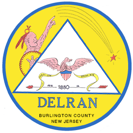
The name Delran is a contraction of the names of the two streams on which the township is located: the Delaware and the Rancocas. The combination name 1880 had an interesting precedent nearby, in that the town of Delanco was named for the same pair of waterways. Beginning in 1848 under the unwieldy title Delaranco, the town modified the name to a more pronounceable Delanco a few years later.
The population of both Delran and Cinnaminson Townships, not too large after the division of 1880, was further reduced in the period 1893-1894 when the towns of Palmyra and Riverton were set off from Cinnaminson, and Riverside was set off from Delran, to become Townships or Boroughs independent of the parent townships. This left both Delran and Cinnaminson as L-shaped townships each with some frontage on river and creek.
Paradoxically enough, the growth of Riverside had been a principal reason for erecting Delran township, and Riverside’s location at the junction of river and creek was a principal reason for the naming of Delran……but only 13 years after the event, the principal reason was no longer a part of the township.
Similarly the “town-house, went its way, but for a different reason. No longer in a location to serve either Cinnaminson or Delran satisfactorily, the town hall was sold and eventually became Frank’s Market on Rt. 130. (This reference is from the 1970’s)
Education in the 1800’s was not tax-supported, except in a very nominal way, until about 1871 when the principle of free public education was at length recognized. Thus, the early “West-Chester” school of 1860 was supported largely by voluntary contributions and by donations from the parents of the children involved. Many of the children from the vicinity in earlier years attended the Westfield Friends School of 1798, which was financed by theSociety of Friends.
When Delran Township was established in 1880, the new theory of public educationhadbecome fairly well rooted. Four school districts included the one in Riverside, the old West-Chester district, and two others carrying the names Bridgeboro District No. 25 and Chesterville District No. 26. All four together operated on a total budget of approximately $2,000. Six teachers were employed at salaries ranging from $30 to $42 per month.
Of the total Delran population of 1760 persons, 348 were listed on the school rolls as “scholars registered.” The average attendance was 173 (just about 50%). The value of the four school properties was listed as-$7,800 total.
By 1907 two new schools were on the scene; one at Bridgeboro, replacing an earlier building, and a new building on the “Burlington Pike” at Fairview. The old stone West-Chester school was closed. Its students attended the new Fairview school, except for a few from Cambridge who were sent to Riverside at tuition of $10 per student. The old Chesterville School, not far from Bridgeboro, was also closed and its students attended the new Bridgeboro School.
Beginning in 1917 experiments were made in bus transportation and double sessions – students from Cambridge and Riverside Park traveling to the school in Bridgeboro which was traveling student run on shifts, local students in the morning and traveling students in the afternoon. This was not too satisfactory, and over the next few years a new school was built at Cambridge, the school at Fairview was closed, and the one at Bridgeboro was enlarged.
Even then, in the 1920’s the school at Cambridge lacked indoor lavatories, the one at Bridgeboro lacked a stage – and although these deficiencies were amended in the late 1930’s the schools, even then, bore only slight resemblance to the institutions of today
The schools in the 1970’s included the Cambridge school,built originally in 1918 as a four room school at a cost of $12,804, the Aaronson Bell School, enlarged in 1951(Now the location of the Delran Intermediate School); the Chester Avenue School in 1960, enlarged in 1964; and the Millbridge School buildt in 1970. Inaddition, Delran is the location of Holy Cross High School, the only Roman Catholic High School in Burlington County.
Across the 120 plus years of Township existence under the present name, population trends have presented a down and sharply up pattern. Beginning at the Delran Township inception in 1880 with 1760 persons, the population actually declined a few years later as a result of the withdrawal of Riverside. The township therefore entered the 20th century at well under the 2000 mark. After a few decades of modest increases, the surge came. In the 1970’s the population stood at 9748. (The estimated population in 2009 is approximately 17,000.)
In the 1970’s population of 9748, 2004 are students. The school budget in the 1970’s was $1,792,000, and 82 teachers are employed in the school system. The numbers of attending students and teachers in 1880 were about 8% of the corresponding figures of the 1970’s. The school budget of 1880, which can hardly be evaluated against today’s figure due to many factors including inflation, was only a tiny fraction of 1% of the present school budget.
Similarly, the law-and-order phase of township operation has grown – from the force consisting of a part-time Constable in 1880 to one consisting of a single full-time policeman in 1924, and on to a force of ten regular police officers and one part-time officer in the 1970’s to over 22 officers in 2009.
Among the meeting halls in the township are those of such lodges and other organizations as the Veterans of Foreign Wars, the OddFellows, and the Polish American Club. Others include the Bishop Neumann Council, Knights of Columbus, which was formerly in Riverside to it’s current meeting place in Delran.
One of the historic organizations of Delran, mentioned earlier under its former name as the Bridgeboro Methodist Church, re-named the First United Methodist Church of Delran and moved to it’s location adjacent to the ancient Conrow house of 1751. (In a version of the history written in 1974, the following text followed: Another Church, of relatively recent years, is the Riverside Park Baptist Church on Stewart Avenue in Delran. Yet another is a new Baptist congregation, which presently holds services in the Aaronson Bell School. NOTE: The site of the Aaronson Bell School is now Delran Intermediate School.)
The PTA of Delran, serving for many years the schools of the township, had its inception in 1916 under the title “The Home and School League.”
The principal roads of Delran Township have historic aspects. The background of Route 130, a road now well over two and a half centuries old, has been mentioned. River Road had its beginnings almost 200 years ago as a public road, following the line of the railroad of 1834, and was a river path at earlier date. Haines Mill Road and Chester Avenue are equally historic — dating to the time of the old mill on Swedes Run and to Chester Township days. Conrow Road memorializes an ancestral family of the area; and it may be hoped that from the above account of the early years the names of other roads, present and to 22 come, will take on a historic meaning.
The pioneers of the early, Chester Township years are buried in such historic cemeteries as those of the Westfield Friends, the Asbury and Bridgeboro Methodist Churches, and the Trinity Episcopal Church.
Over 85 years ago; in 1924, the township officials included Committeemen William F. Kauderer, John Grob and George Caldwell; Collector Samuel H. 2i4gler; Assessor George Friday Sr.; Clerk George B. Litle; Justice of the Peace John E. McNulty; Constable Harry Kortman; and Overseer of the Poor John E. McNulty.
It is doubtful however whether any of these, or any official of today, could match the highly diversified activity of that versatile official of 1880, Rudolph Stecher — who had a full-time operation day and night as proprietor of the “Riverside Station Hotel,” and managed also to hold down three Delran Township posts that must have kept him on the jump at all hours: as Pound Keeper, Constable, and Overseer of the Poor. Nor were there either automobiles or telephones to assist — which may have been just as well!
The township leaders in 1974, were Mayor John J. Gizara, Deputy and Director of Public Works Joseph Truglio, Director of Parks and Playgrounds Lorraine Schmierer, Director of Finance and Administration Frank J. Killino, Director of Public Safety George H. Hulse, Collector George B. Barton, Welfare Director Stella Hekierski, Fire Marshal Ronald Hubbs, Treasurer Daniel McDermott, Zoning Officer Henry Beyerle, Recorder William J. Smith, and Clerk Frances P. Bauer.
It is to be remembered that Delran Township in the 1970’s, approaching its 100th anniversary under the present name , had been a place of settled population for almost 300 years. Its earliest pioneers pre-dated the coming of churches, schools, or roads, and were dependent upon boats for transportation. Thus, the adjacent waterways were responsible for the early settlement of the area that is now Delran — a fact that adds historic significance to the Township name.
Today, amid a population many times greater than that of even fifty or one hundred years ago, it is difficult to envision the primitive era. One wonders, conversely, what the pioneers might make of the what was the Millside Heights Shopping Center (now Target Center) near the old mill stream, or of Tenby Chase, the then Millside Manor Apartments (now Hunters Glen Apartments), or of the housing development named for ancient Swedes Run!
Note: The Town Council is seeking input from local historians to review and provide updates to this history. Most of this history was written by Lloyd S. Griscom in 1974 with minor updates when the new township website was launched in April of 2009.